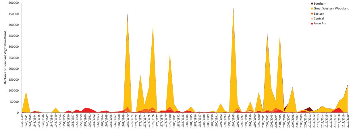
Land clearing, primarily for agriculture, has arguably had the greatest impact on species viability in the Wheatbelt region. Around 60% of the native vegetation of the Avon River Basin has been cleared since European settlement (Department of Agriculture and Food) and an average of ~2500 hectares have been approved for clearing per year since 2010 (Department of Environmental Regulation). The extent and composition of our native vegetation can also be variously affected by fire, secondary salinity and climate change. As we collate data will we be increasingly able to comment on whether the area of perennial vegetation cover is increasing or decreasing across the region.
Based on the latest remnant vegetation mapping by the Department of Agriculture and Food, we can see that with the exception of the Great Western Woodlands which are virtually uncleared, every sub-region of the Wheatbelt NRM region falls well below the threshold of 30% land cover. This threshold has been identified in the literature on biodiversity conservation below which species numbers rapidly decline. Our challenge is to manage the region to improve species viability by increasing perennial landcover to exceed this threshold. About 25% of our remaining native vegetation is protected in crown reserves and under freehold covenants and non-binding agreements while revegetation efforts on freehold land continues. In these ways we can protect, enhance, enlarge and connect our remaining bushland.